Our curriculum vision at Newlyn School:
At Newlyn School, we believe Geography helps children make sense of the world around them. Through exploring places, people, and environments—both near and far—we nurture curiosity, respect, and a sense of responsibility for our planet. Geography supports our wider school vision by encouraging children to be resilient, independent learners who are equipped to face life’s challenges and contribute positively to their communities. A key part of our approach is the belief in "belong"—helping children feel connected to their local area and community. This sense of belonging is central to our teaching of local place and fieldwork, encouraging pupils to value where they live and understand their role within it.
“A people without a knowledge of their past history, culture and origin is like a tree without roots. “ Marcus Garvey
Intent
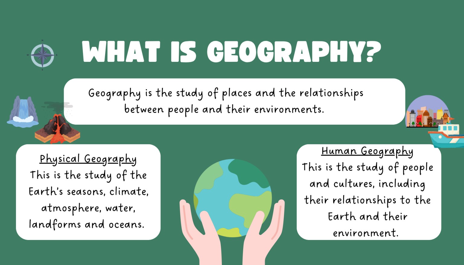
Our Geography curriculum is designed to spark interest and wonder about the world. It builds on children’s natural curiosity and helps them develop a deep understanding of physical and human geography. We aim to give pupils the knowledge, skills, and vocabulary they need to explore global issues, understand their local environment, and become thoughtful, informed citizens of the future.
We place strong emphasis on helping children belong—to feel rooted in their local area and to appreciate its unique geography. This supports their emotional wellbeing and strengthens their understanding of place.
Implementation
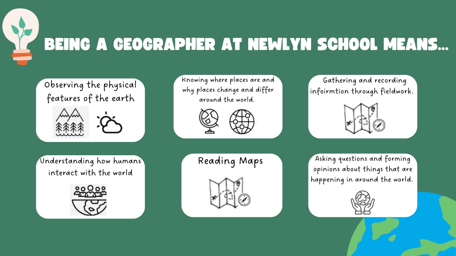
Geography is taught through a carefully planned and sequenced curriculum that follows the National Curriculum 2014. Lessons are enriched with practical experiences including fieldwork, map reading, and enquiry-based learning. We make meaningful links across subjects and tailor our teaching to meet the needs of all learners, ensuring every child can access and enjoy Geography.
Impact
By the end of each key stage, children will have a secure understanding of geographical concepts and processes. They will be able to ask and answer questions about the world, use geographical tools confidently, and explain how people and places are connected. Our pupils leave Newlyn with a strong foundation in Geography and the skills to continue exploring the world with curiosity and care.
Assessment
At Newlyn School the impact of learning in geography is assessed by:
- children being able to talk about their learning. This may be prompted by visual icons from topic ogranisers.
- verbal questioning throughout all learning opportunities
- children having opportunities to ‘show what you know’ in lesson assessments via Seesaw. This may include icons, diagrams, or any other written form
- reference to recording of learning through photograph, audio recording or video through our live capture of Seesaw.
- misconceptions identified and recorded on the subsequent session’s command module
- retrieval opportunities throughout the unit of learning
- weekly retrieval opportunities outside of the geography lesson
- Half-termly Quizz assessments (KS2)
Why We Use Seesaw in Geography Instead of Traditional Books
At Newlyn School, we use Seesaw as a digital platform to support Geography teaching and learning. This approach reflects our commitment to inclusive, engaging, and forward-thinking education.
Here’s why Seesaw is particularly effective for Geography:
-
Captures Learning in the Moment
Geography often involves practical, real-world experiences—especially during fieldwork and local studies. Seesaw allows pupils to instantly record their observations, reflections, and findings through photos, videos, voice notes, and drawings. This helps us capture authentic learning as it happens. -
Accessible for All Learners
Seesaw supports a wide range of learning styles and needs. Whether children prefer to speak, draw, type, or record, they can express their understanding in a way that suits them. This ensures every child can participate fully in Geography lessons. -
Supports Assessment Without Barriers
Using Seesaw enables teachers to assess geographical skills and understanding directly—without the limitations that sometimes come with traditional written work. We can clearly see how pupils interpret data, use geographical vocabulary, and apply enquiry skills, giving us a more accurate picture of their progress. -
Strengthens Local Place Learning and Belonging
Seesaw is a powerful tool for helping children connect with their local area. By documenting fieldwork and local studies, pupils develop a sense of belonging and pride in their community—an important part of our Geography curriculum at Newlyn. -
Encourages Creativity and Curiosity
Geography is a dynamic subject, and Seesaw allows pupils to explore it creatively. From interactive map work to environmental investigations, children can present their learning in varied and imaginative ways.
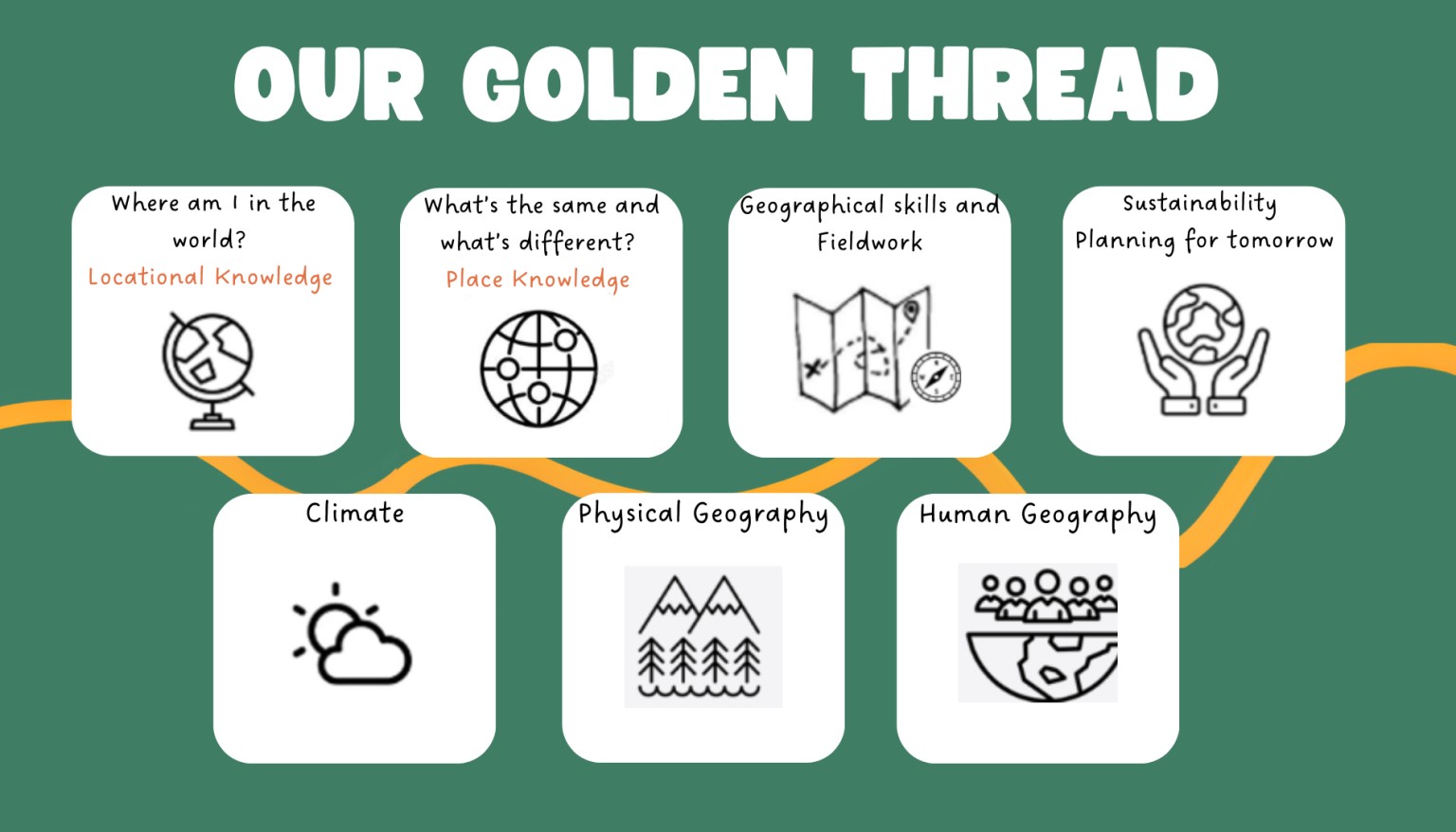
Newlyn School's Geography Golden Thread
Our Geography curriculum is built on six key threads that run through every stage of learning, helping pupils make sense of the world:
-
Locational Knowledge – Understanding where places are in the world, using maps, globes, and digital tools to build a strong sense of global and local geography.
-
Place Knowledge – Exploring the characteristics of different places, comparing environments and cultures both near and far.
-
Climate – Investigating weather patterns and climate zones, and understanding their impact on people, places, and the environment.
-
Human Geography – Learning how human activity shapes the world through settlements, trade, land use, and population.
-
Physical Geography – Studying natural processes such as rivers, mountains, coasts, and volcanoes, and how they create and change landscapes.
-
Sustainability – Encouraging awareness of environmental responsibility, resource management, and how to protect our planet for future generations.
-
Fieldwork & Geographical Skills – Building practical skills in observation, data collection, map reading, and analysis through hands-on exploration and enquiry.
Core Principles of Our Pedagogy:
Engagement with the Local and Global Environment
-
Local First, Global Later: We begin by exploring the local environment of Newlyn and the surrounding areas. By examining local geography, pupils can connect more deeply with the subject, developing a sense of place before expanding their learning to national and global contexts.
-
Real-world Learning: Through field trips, local case studies, and environmental surveys, pupils learn to make real-world connections and apply their knowledge.
Active Learning through Inquiry
-
Curiosity-driven Teaching: We encourage pupils to ask questions and explore geographical issues through inquiry. Questions like “Why do we have different climates?” or “How do rivers shape our land?” help spark curiosity and lead to deeper investigations.
-
Problem-Solving Focus: Pupils are encouraged to analyse geographical problems, think critically, and consider how people can address real-world challenges such as climate change, urbanization, and sustainability.
Developing Geographical Skills
-
Practical Skills Development: Pupils engage in hands-on activities such as map reading, using compasses, conducting fieldwork, and using digital tools for mapping (GIS, online maps, etc.).
-
Geographical Tools: Early stages of learning focus on essential geographical skills, including how to read maps, understand scales, symbols, and coordinates, and use atlases and digital resources.
Linking Geography to Other Subjects
-
Cross-curricular Learning: Geography is interwoven with other subjects, such as Science (climate studies, ecosystems), Maths (using coordinates, graphs, and measurements), and Literacy (writing reports, describing places). This ensures that Geography is relevant and interconnected with other learning experiences.
-
Digital Literacy: Integration of digital technologies in Geography allows students to interact with interactive maps, satellite imagery, and virtual field trips to enhance their learning experience.
Inclusive and Differentiated Approach
-
Inclusive Teaching: Geography is taught in ways that are inclusive of all learners, taking into account diverse abilities, backgrounds, and interests. Pupils with special educational needs are supported by differentiated tasks and resources.
-
Personalized Learning: We ensure that activities are challenging and appropriately scaffolded for all students, encouraging deeper thinking for greater depth learners and providing support for those who need it.
Building Knowledge and Conceptual Understanding
-
Progressive Learning: As students’ progress through the Key Stages, the geographical content and skills are built upon. In Key Stage 1, pupils focus on simple concepts like the local environment and basic map work. By Key Stage 2, pupils investigate more complex themes like human and physical geography, global patterns, and environmental issues.
-
Big Ideas in Geography: We introduce “big ideas” such as interdependence, sustainability, and environmental change. These ideas help students think critically about their role in the world and how they can contribute to a sustainable future.
Inclusive Geography Teaching at Newlyn School
Geography at Newlyn School is designed to be accessible, engaging, and meaningful for all pupils. Key geographical skills—such as map reading, using atlases, and fieldwork—are taught using strategies that support a wide range of needs, in line with the four areas of SEND.
Communication and Interaction
Needs may include: Autism, Speech, Language & Communication Needs (SLCN)
Strategies for Map Reading, Atlases & Fieldwork:
-
Use visual symbols for map keys and fieldwork instructions.
-
Provide clear, step-by-step instructions with visual support (e.g. photos or diagrams of locations/equipment).
-
Use social stories or visual guides to prepare pupils for fieldwork locations and routines.
-
Model how to use maps or compasses in a structured, repetitive way.
-
Use of structured talk tasks (e.g. “talk partners”) when analysing maps or geographical data.
-
Pre-teach key vocabulary with visuals and offer word mats during lessons.
Cognition and Learning
Needs may include: Dyslexia, Moderate Learning Difficulties, Global Developmental Delay
Strategies for Map Reading, Atlases & Fieldwork:
-
Provide dyslexia-friendly atlases and printed maps (clear fonts, high contrast).
-
Offer simplified maps with reduced detail to focus on core learning.
-
Use colour-coded keys and symbols for easier interpretation.
-
Enable use of digital mapping tools (e.g. Google Earth) to support spatial understanding.
-
Allow alternative methods of recording (photos, drawings, voice notes).
-
Scaffold fieldwork tasks with checklists, templates, and worked examples.
-
Build in regular review and repetition of key concepts and map skills.
Social, Emotional and Mental Health (SEMH)
Needs may include: Anxiety, ADHD, Attachment Difficulties, Behavioural Needs
Strategies for Map Reading, Atlases & Fieldwork:
-
Prepare pupils for new or unfamiliar settings with visual prompts and adult reassurance.
-
Offer low-demand, success-oriented map tasks to build confidence (e.g. identifying their local area).
-
Provide calm, structured roles during fieldwork (e.g. map holder, recorder).
-
Allow quiet breakout spaces for regulation before/during fieldwork.
-
Ensure pupils know the purpose and value of geographical tasks to support motivation.
-
Use praise and positive reinforcement for engagement and effort.
Sensory and/or Physical Needs
Needs may include: Visual impairment, Hearing loss, Dyspraxia, Physical disabilities
Strategies for Map Reading, Atlases & Fieldwork:
-
Offer large print or tactile maps, raised line drawings, or audio descriptions for visually impaired pupils.
-
Use subtitled videos and written instructions to support pupils with hearing impairments.
-
Provide digitally accessible atlases (with zoom, text-to-speech, etc.).
-
Offer pre-filled map templates for pupils with fine motor difficulties.
-
Consider alternative recording formats for fieldwork (e.g. verbal reports, photos, voice memos).
-
Adapt fieldwork to be physically accessible with appropriate routes, risk assessments and resources.
-
Allow additional time and adult support for practical tasks.
General Inclusive Teaching Approaches for Geography Skills
-
Use multi-sensory resources: digital maps, 3D models, images, physical artefacts.
-
Allow pupils to show understanding through speech, drawing, building, or digital work.
-
Provide scaffolded resources like sentence starters, key vocab mats, and checklists.
-
Ensure learning objectives are clear and chunked into manageable steps.
-
Use paired or small-group work to promote collaboration and peer modelling.
-
Encourage curiosity and independence, with adult support available where needed.
-
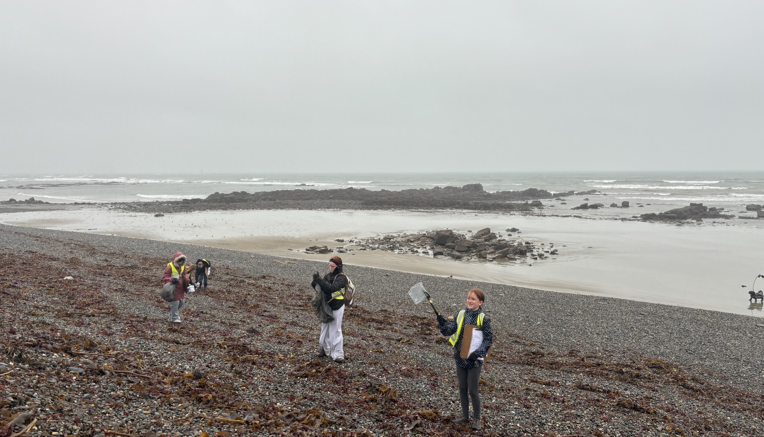
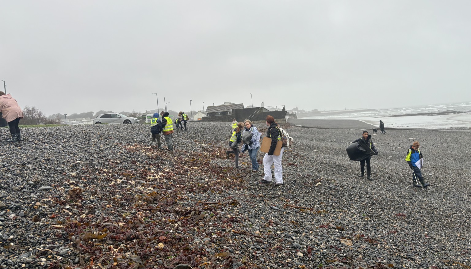
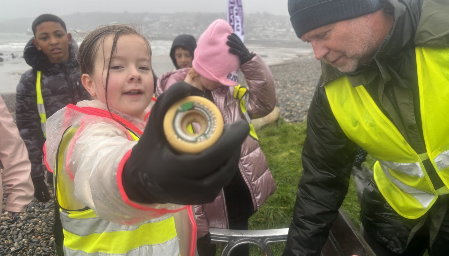
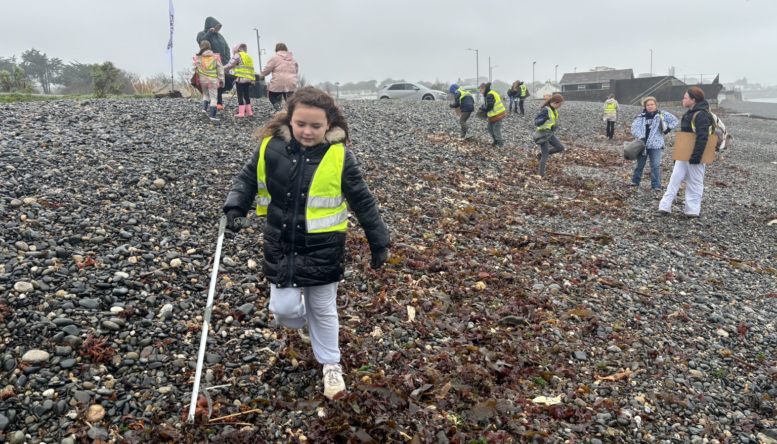
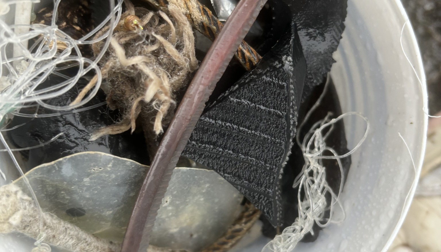
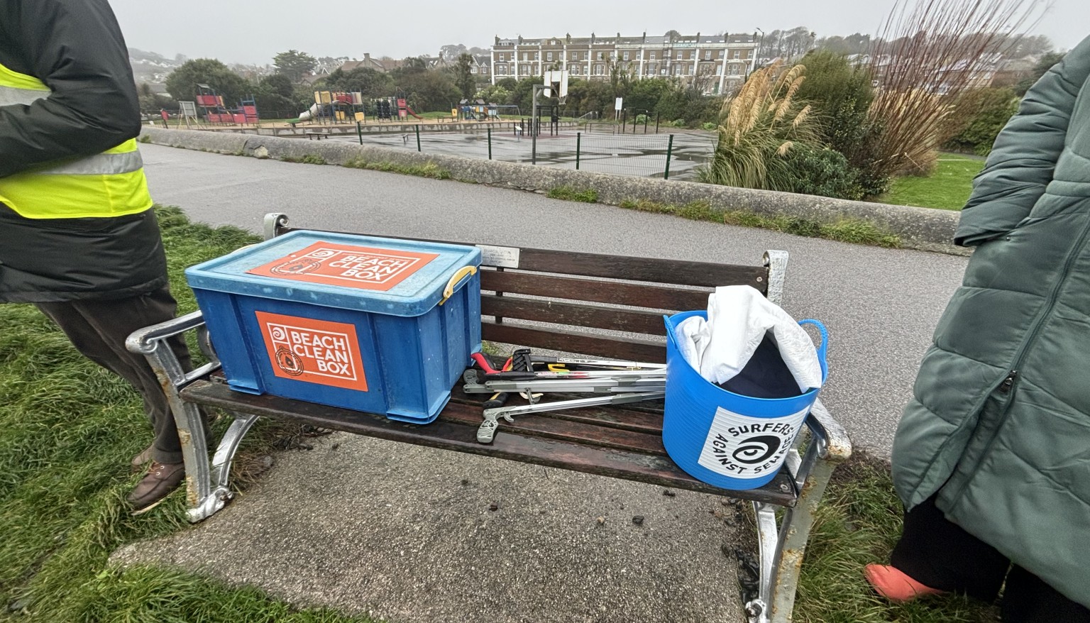
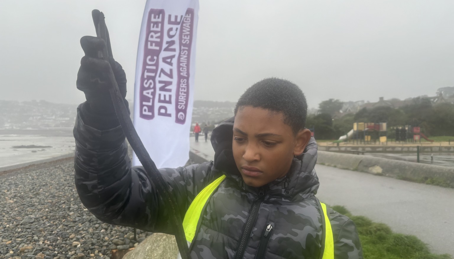
Year 6 Field Work - Plastic Pollution Investigation
-
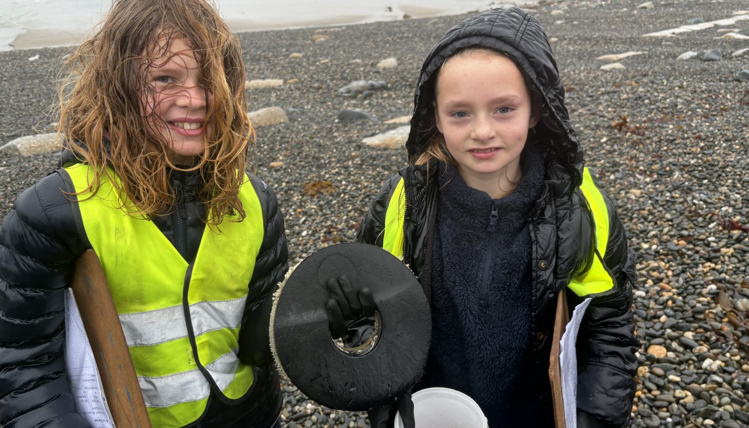
Year 6 Field Work - Plastic Pollution Investigation
-
Year 6 Field Work - Plastic Pollution Investigation
-
Year 6 Field Work - Plastic Pollution Investigation
-
Year 6 Field Work - Plastic Pollution Investigation
-
Year 6 Field Work - Plastic Pollution Investigation
-
Year 6 Field Work - Plastic Pollution Investigation
-
Year 6 Field Work - Plastic Pollution Investigation